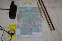
 When working with maps
there are some key points to remember, especially when using a map in conjunction
with a compass and a Global Positioning System (GPS) receiver.
Datum
Maps made based on a
datum (horizontal and vertical). Datum is
the origin from which all points on a map are measured. Three primary datum have
been used to develop maps in the United States.
These are:
- North
American Datum of 1927 (NAD27)
- North
American Datum of 1983 (NAD83)
- World
Geodetic System of 1984 (WGS84).
Datum is a mathematical
model that accounts for developing a map from a spheroid (the earth) to a flat
map.
When using a GPS
receiver the datum must be set to match the horizontal datum on the map. If the
datum does not match, there will be errors when plotting data on a map.
Map datum information is
found in the title block at the bottom left corner in the margin of a USGS map. Other maps (e.g., US Forest Maps and
commercial maps) seemingly provide datum in rather random locations. The hiker
will have to scan the map to find this information.
Geographic
North
Maps are laid out in
relation to geographic North (also referred to as the north pole or true north.)
This is important to remember because the traditional magnetic compass provides
information based on magnetic north. Magnetic north changes over time, while
geographic north does not change. The difference is referred to as magnetic
declination. When using a compass and map together the hiker must account for
this difference. Because of this I
recommend that the navigator have an adjustable compass such as the Sylva
Ranger.
For more on declination go here.
Maps
Are Not Perfect
For a map to be
considered reliable and accurate, map symbols marked on a map must be in proper
relation to known landmarks or positions located on the ground. In 1947, the “United States National Map
Accuracy Standards” were established as the standards of accuracy for published
maps and are currently in effect. The standards require a stringent percent of
accuracy within centimeters of both location and elevation of points tested.
However, even with these standards, maps are not absolutely accurate because:
- Maps
represent a curved and uneven surface that is drawn on a flat piece of
paper, which results in a distorted picture.
- There
is a margin of error (human error and inadequate survey procedures) in
surveys that were used to create maps. Also, there are factual matters
(errors such as names, symbols of features, and the classifications of
roads or woodlands); sometimes the information is wrong and names and features
change.
- If a map has been photocopied, it most likely is not to
scale.
- Maps editions are dated and not current.
Maps do
not accurately represent the ground surface
Topographic maps provide an overview
of the ground surface. A USGS 7.5
minute map uses a scale of 1:24,000. This means that 1” of map distance equals
2000’ feet on the ground. 1square inch
on the map is equal to 91 acres on the ground.
The symbolic information provided by
colors provides only a general description on the ground. For example, green coloration refers to
vegetation such as forested areas. But
what color does not tell you what is the surface really like? The map doesn’t tell the hiker if the area is
full of brush, blown down trees or large area of loose rock.
Resolution
Though maps are not perfect there are
things the hiker can do to lessen the issue with maps. Here are some suggestions:
- Review
trail guides of area to be visited.
- Visit
with other hikers that have been to the same area earlier.
- Visit with government agency officials such as:
- Forest
Service Backcountry Rangers
- Fish
and Game law enforcement officials.
- Biologists
- Search
and Rescue organizations in the
county to be visited
- National
Park Rangers
The reference for this post is Basic
Land Navigation produced by the National Wildfire Coordinating Group
(NWCG.) This is a straight forward document
that covers the essential elements of land navigation: it is a good
introduction and the source for this post. This is a free publication. Down load it here: http://www.nwcg.gov/sites/default/files/products/pms475.pdf.
No comments:
Post a Comment