What works to sharpen my knives? This is what works for me.
My friend Leon recently wrote a fine post about what knife to carry in your pack. He provided several recommendations.
This post supplements Leon's by discussing how to keep that knife sharp. What kind of knife sharpener I would want in my pack.
There is no better way to spark a campfire discussion than to offer your suggestion on what is the best knife sharpener or sharpening system. Opinions vary greatly. There will be lots of experts. My intent is to discuss what works for me.
Over many years I have experimented with an electric sharpener, wet stones, ceramic sticks and steels. Most were satisfactory but I was looking for something that was portable, consistently provided a keen edge, worked well both in the field and kitchen and didn't require a box to keep all the implements together. I sought a tool that would sharpen quickly. I was not looking for a tool that would turn my knife into a razor. I was looking for something simple.
At a Outdoor Show in 2005 I bought a sharpener made by Edge Maker (visit http://www.edgemakerpro.com/). I liked it so well that I purchased several as gifts.
The price was less than $20.00.
The model to the left has crossed metal sticks that you pull through. One set sharpens your knife blade; it gets you started. The other hones the blade and is the final step. As I pull or draw my knife's blade I'll vary the pressure so that at the end I apply minimal pressure while honing. I've used this system on my German kitchen blades, my hunting knives and most recently on a Case kitchen knife purchased at a local thrift store.
It there a draw back? The first worth discussing is that with an extremely dull and beat up knife you will pull some metal away from the blade. If the knife is in really tough shape consider that you are restoring the bevel to the blade. Second, the crossed metal sticks can develop flat spots. The manufacturer's packaging discusses how to fix this by using a process actually twists the metal sticks. That said, I have used my set on many, many knives and have yet needed to accomplish this repair.
Similar to the Edgemaker product is a tool called the Hunter Honer.
The first noticeable difference is that it is compact and takes up far less space than the Edgemaker sharpener. I have sharpened a few knives with fine results. This model offers two methods of sharpening the blade. The first is to dry hone the steel as you would with the other unit. Pulling the knife through with modest pressure. The other options is to use a small amount of honing oil (provided with the sharpener) to develop and even sharper edge.
The suggested retail price is $29.00.
Leon's article can be found here.
This blog is about teaching, instructing and sharing practical applications to navigation, GPS technology and survival in the backcountry.
Map, Compass & GPS
Wild flowers along Fall Creek on the way to the Green Lakes - Oregon
Tuesday, October 25, 2011
Topo Maps - Your Key To The Backcountry
A quality topograhic (topo) is your key to backcountry navigation. Coupled with a compass and GPS, a topo is an important planning tool that identifies land features, contours, trails and resources.
Reviewing a topographic map is usually the starting point for the planning of any back country trip. A topographic map is your road map to the outdoors. It provides you detailed information at a scale that is meaningful and detailed. For years, the US Geologic Survey (USGS) has been the principal publisher of accurate maps. Within the last decade we have seen many innovations in mapping products that include new mapping companies and publishers, software, maps for the GPS, and “Apps” for the iPhone.
Still, the USGS map remains the standard for back country navigation (visit the USGS’s site at www.topomaps.usgs.gov.) I’d also recommend looking at June Fleming’s “Staying Found” or Bjorn Kjellstrom’s “Be Expert With Map & Compass.” Once you develop a map foundation you will easily shift to many of the other products on the market today.
Many publications, videos, and web sites will give you a complete rundown on the features, symbols and components to a map. This article will discuss a few of the key features that you should be aware on a 7.5 minute map.
To read the rest of the post go here.
Sunday, October 23, 2011
The Right Knife For Your Pack
Best Choices for Backpacking Knives
by Leon Pantenburg
Elk Lake, Oregon is one of the major re-supply places for through hikers on the Pacific Crest Trail. Every year, a handful of long-distance hikers will walk border-to-border on the trail. They generally start in Mexico in April, and start trickling in to the Elk Lake Resort about August, en route to Canada.
I was eating lunch, and noticed a young lady trekker loading her pack for the next section. She had opened her re-supply box, sliced a chunk of cheese, opened several large packages and cut a shoelace, all with her tiny, Classic Swiss Army knife.
“It’s all you need,” she commented. “I have to go lightweight and I don’t carry an ounce that isn’t needed.”
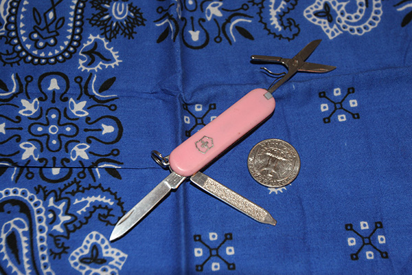
I carry a Swiss Army Classic on my keyring everywhere. (To read my review of the Swiss Army Classic, click here. And for lightweight hikers, who go long distances with minimal equipment, a Classic may be a reasonable choice. On a well-traveled trail like the Pacific Crest or Appalachian, you’ll seldom be isolated from other hikers for very long.
But that doesn’t mean you don’t need a knife for backpacking. Get separated from the group, off the beaten path in the backcountry, or in some sort of wilderness survival situation and you may desperately need the appropriate knife.
If I could only pick one tool to take along in the wilderness, it would be a knife. The uses are limited only by your imagination. But which one is best for your backpacking needs? How do you balance weight versus practicality?
To read the rest of Leon's post go here.
I was eating lunch, and noticed a young lady trekker loading her pack for the next section. She had opened her re-supply box, sliced a chunk of cheese, opened several large packages and cut a shoelace, all with her tiny, Classic Swiss Army knife.
“It’s all you need,” she commented. “I have to go lightweight and I don’t carry an ounce that isn’t needed.”
I carry a Swiss Army Classic on my keyring everywhere. (To read my review of the Swiss Army Classic, click here. And for lightweight hikers, who go long distances with minimal equipment, a Classic may be a reasonable choice. On a well-traveled trail like the Pacific Crest or Appalachian, you’ll seldom be isolated from other hikers for very long.
If I could only pick one tool to take along in the wilderness, it would be a knife. The uses are limited only by your imagination. But which one is best for your backpacking needs? How do you balance weight versus practicality?
To read the rest of Leon's post go here.
Friday, October 14, 2011
Compass Navigation
Topic Two: Moving Through the Backcountry. This post deals with the considerations a hiker should take while navigating and moving through the wilderness.
Before leaving for a backcountry trip, there are three important steps to accomplish before leaving home. First, tell someone where you are going and when to expect your return. Second, leave a map of your planned route with that responsible person and in your vehicle. Third, fill out the trip plan I have posted on my web site at www.outdoorquest.biz/Links.htm; the trip plan stays with the responsible person. As a Search and Rescue volunteer I have learned that these key steps can make a huge difference in you having to spend an unplanned night in the woods and being found----especially if you incur an unexpected injury or loss of communication.
The following are suggestions to consider before and during a trip into the backcountry.
While compass accuracy is important, many underestimate the topographic map as a key component in backcountry navigation. I recommend carrying a set of maps that include a 7.5’ United States Geological Survey (USGS) map and a map like a United States Forest Survey map. The USGS map gives me the detail information of the immediate area while the other map covers a much broader area. I look for significant land features that will surround my direction of travel. Features such as distinct mountain peaks, a stream, and a ridge line are just of few topographic “hand rails” that can help. For example, if a large stream is to be on your right and it’s not there, it is time to double check your navigation picture.
Figure 1
Additionally, every hiker must account for declination before leaving the trailhead. I like to keep my navigation simple and personally use a compass that can be adjusted for declination such as the Brunton 8010G. This way I don’t have to worry about the math (do I add easterly declination or subtract it?) Declination information found at the bottom of a topographic map is frequently out of date. Check the web site www.magnetic-declination.com to obtain the declination for the location you will be visiting. For more detailed information on declination visit www.outdoorquest.biz/PostsonLandNavigation.htm.
To read the rest of the post go here.
Wednesday, October 12, 2011
Getting Your GPS Ready For Your Fall Hunt
Tune up your GPS before you leave for the woods. "Dump the junk" and be ready for the backcountry.
With Elk season approaching, last month was range time with my favorite rifle. I spent several hours sighting-in that rifle and testing my preferred reloads. Altogether, I’ve spent probably five hours shooting, adjusting and cleaning my firearm. Then I am spending time getting gear together, going through my check list to make sure I won’t leave anything behind. I am all done right; wrong.
If I am like the average hunter I am only about 90% complete. To ensure that all my preparations are done correctly I need to factor in my land navigation. I have a few suggestions to get your GPS receiver ready for your trip.
- “Dump the Junk” – Delete those old waypoints from last year. Save old waypoints on your PC by using a free program found at www.easygps.com, or write them down on a piece of paper. Don’t use your GPS as a filing cabinet.
- Open the GPS’s main menu option and then select tracks. Select the option that allows you to clear your tracks or track log. Tracks are what folks call the “bread crumb” trail and can be seen on your map page.
- Visit your receiver’s manufacture’s web site to see if there are any software updates. You won’t improve the maps that may have come preloaded but upgrades will improve the efficiency of your receiver’s operation. Only download the upgrade that specifically matches your GPS.
To read the rest of the post go here
Monday, October 10, 2011
The Hiker's Checklist
This is a fine article by Matthew Sturdevant from the Hartford Courant.
Just what should the hiker carry in the backcountry?
On a vivid day last fall as the leaves ripened to their fiery hues my fiancee, Susan, and I hiked through woods nearTerryville.
Our itinerary was explained simply in an online hiking guide: walk in, hike a loop for a few miles and return to our starting point. Trouble is, the trail markers we were supposed to follow were about as common as fallen leaves zigzagging in a labyrinth through the woods. A few hours later and we had wandered into another county — ending up on Johnny Cake Mountain Road in Burlington.
It was dusk. No way were we going back into the woods to retrace our steps. Following the road back to our car would take more than a couple of hours because there is no direct route. We took the easy way out and called a friend for a ride.
Just what should the hiker carry in the backcountry?
On a vivid day last fall as the leaves ripened to their fiery hues my fiancee, Susan, and I hiked through woods nearTerryville.
Our itinerary was explained simply in an online hiking guide: walk in, hike a loop for a few miles and return to our starting point. Trouble is, the trail markers we were supposed to follow were about as common as fallen leaves zigzagging in a labyrinth through the woods. A few hours later and we had wandered into another county — ending up on Johnny Cake Mountain Road in Burlington.
It was dusk. No way were we going back into the woods to retrace our steps. Following the road back to our car would take more than a couple of hours because there is no direct route. We took the easy way out and called a friend for a ride.
I didn't expect to get lost during such a short day hike in a patch of Connecticut woods. As an Eagle Scout raised in a camping family and a wilderness canoe guide for five summers in Maine, I thought nothing of a short afternoon jaunt in the Nutmeg State. We couldn't possibly stray too far, right? Wrong.
To read the rest of Matthew's article go here.
Oregon Hunter Rescued
Oregon hunter rescued from the Mount Jefferson Wilderness. Thankfully they had all the right gear.
PORTLAND, Ore. --
The Jefferson County Sheriff’s Office Search and Rescue Team, along with Linn County Search & Rescue and the Deschutes County Search & Rescue Horse Team, undertook an all-day rescue effort for Mike McLaughlin, 59, of the Portland suburb of Clackamas, said Jefferson County sheriff's Capt. Marc Heckathorn.
McLaughlin fell while hunting in the Jefferson Lake area late Friday afternoon, making it impossible for him to walk out with his son-in-law and hunting partner, Brett Yeager, Heckathorn said.
Yeager helped him into a sleeping bag and tent and climbed down the mountain for help, taking about four hours along an overgrown trail, Heckathorn said.
A plan was devised, and teams from Jefferson, Linn and Deschutes counties began the search at 6 a.m. Saturday. Teams went in by two different routes, utilizing parts of the Pacific Crest Trail. The first team reached McLaughlin at around 1 p.m., and he was evaluated by medics, Heckathorn said.
The overgrown trail system in the area hampered rescue efforts, making the seven- to eight-mile trek very slow, the sheriff's captain said.
McLaughlin was brought by horseback to the Cabot Lake Trailhead, where he arrived around 8 p.m., Heckathorn said. He then left the area in a private vehicle to seek additional medical assistance, Heckathorn said, adding that he was in stable condition.
Yeager's father, Gary Yeager, said the two had gone up Thursday night and on Friday afternoon decided to switch locations.
“They were all packed and ready to go when Mike just stepped funny,” he added. “He couldn’t put any pressure on it.”
Brett Yeager then set the tent back up and made sure McLaughlin was in a sleeping bag and had plenty of food, then he started hiking back out.