
Can too much technology in the backcountry be dangerous? Can you depend on GPS and other electronic devices and technology to the point of it becoming deadly?
That seems to be an increasingly recurrent pattern of behavior in some parts of the country, as the following story: “Death By GPS’ indicates.
Any GPS can mislead you or give inaccurate information.
Whenever I see a particularly interesting or, in this case, disturbing story related to land navigation, I forward it for comment and analysis to land navigation expert Blake Miller.
Here are my thoughts on “Death By GPS” by Tom Knudson, and published in the Jan. 30, 2011 “Sacramento
The scenario mentioned in the “Death By GPS” story is consistent. Drivers rely solely on their car GPS for directions, they have no map and mostly likely, didn’t talk to anyone about their planned trip.
In Death Valley , 12 vacationer have died under these circumstances over the last 15 years. In Oregon
A Death Valley Search and Rescue coordinator commented that: “GPS units are not only fallible but send people across the desert where no road exists.”
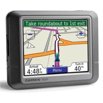
I was surprised just how much backcountry road information was provided by the car GPS (a Garmin Nuvi) during a deer hunt last fall on the western slopes of Oregon ’s Cascade Mountains . But GPS road data can be dated. The article commented that some GPS receivers reported closed roads (as active) that had not been used in 40 years!
When traveling with a car GPS, my recommended planning considerations include:
• Always carry a map. Maps from the American Automobile Association are a great place to start and complement the car GPS. National Geographic has maps of many of our national parks and are well worth the investment. Delorme’s state gazetteers are wonderful for big picture planning. For deep backcountry travel consider a quality topographic map. (For more information click here.)
• Always check in with authorities who can help with your travel planning. Visiting the local Ranger station and visitor center is a good first step. Ask about road and climatic conditions for the area you will be visiting, and what roads are under construction, are permanently closed or are impassible. Many states have online travel sites that provide current conditions. (In Oregon
• Internet sources may well have the same issues as GPS receiver data bases. Many sites
on the web provide topographic mapping. Take care to notice the age of the maps. Much can be out of date. Google Maps/Earth are fine products when used intelligently.
on the web provide topographic mapping. Take care to notice the age of the maps. Much can be out of date. Google Maps/Earth are fine products when used intelligently.
• Place “via points” into your GPS. For example, to keep you on the desired route, insert new destinations so that you’ll stay on the right path. You can add a small town or intersection as a “via point.” This will cause the GPS to use the route you determine, rather that what the data base builds.
• A personal locater beacon such as those made by SPOT and ACR are excellent tools to alert authorities when in trouble. The small units are carried in addition to your GPS.
• Always let a responsible person know of your plans. This person is someone you will coordinate with in advance of your trip. For example, if you don’t return from your journey this person will call 911; the search doesn’t start until 911 is called. For a suggested trip plan look here.
• Whether traveling on foot or in a car always have the Ten Essentials with you. This is your emergency kit that will go a long way toward sustaining you and your party. For information on the Ten Essentials go here.
You have to be smarter than your electronics. Electronics are our aids, not our decision makers!
No comments:
Post a Comment